On October 15, 2025, the Bismarck City Commission voted to send a revised extraterritorial area (ETA) map to the Burleigh County Commission for consideration. The new map redraws boundaries of land just outside city limits—areas that may one day be subject to Bismarck zoning and land-use control.
If Burleigh County rejects the map, Bismarck may even consider withdrawing from their existing joint powers agreement—putting the future of development control in limbo.
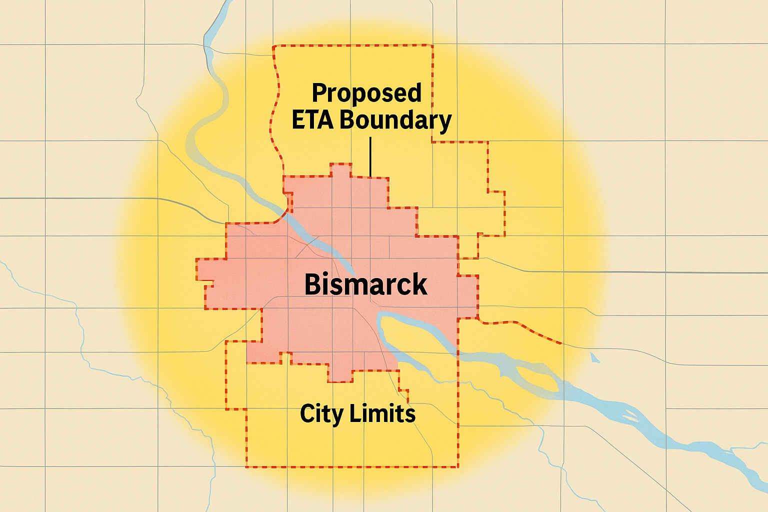
The ETA is a zone extending up to four miles outside the city that allows Bismarck to partially influence planning, zoning, and utility extensions. Each year, Bismarck’s Growth Phasing Plan is amended to reflect anticipated development beyond city limits. This year’s update offers an opening for renegotiating ETA lines. Meanwhile, Bismarck is overhauling its zoning code (Title 14) into a new Land Development Code (LDC) to simplify and modernize how development is regulated. The LDC update is slated for full draft adoption between October and December 2025.
Together, the ETA revision and LDC change set the stage for how Bismarck will grow—or resist growth—into its fringes.
On Oct. 7, Burleigh County released a proposed ETA map for public review, reflecting areas it believes should fall under county planning rather than Bismarck’s reach. The Oct. 15 City Commission vote adopted Bismarck’s staff-proposed map and forwarded it to the county.
Bismarck Mayor Michael Schmitz defended the map: “We worked to create a way for 95% of residents to move from the ETA to Burleigh County.” But Burleigh’s commissioners have shown resistance—making the joint powers agreement’s future uncertain.
“This is an extremely layered issue, but I believe the best outcome … comes in the form of a compromise,”— Mayor Michael Schmitz on the revised ETA boundaries.
Local landowners in the fringe areas are watching closely. One resident (who asked to remain anonymous) said, “If my property ends up inside the ETA, my ability to build or subdivide could change overnight—taxes, zoning, everything.”
Planning staff have presented technical maps and impact data, but many neighbors say they want more clarity before decisions are final.
Boundaries are more than lines on a map. They determine control: over zoning, over roads, over how Bismarck grows. With the ETA map in flux and the new Land Development Code on the horizon, local voices—from farmers to developers—must stay engaged. Because where the line falls will shape the future of Bismarck’s outskirts.